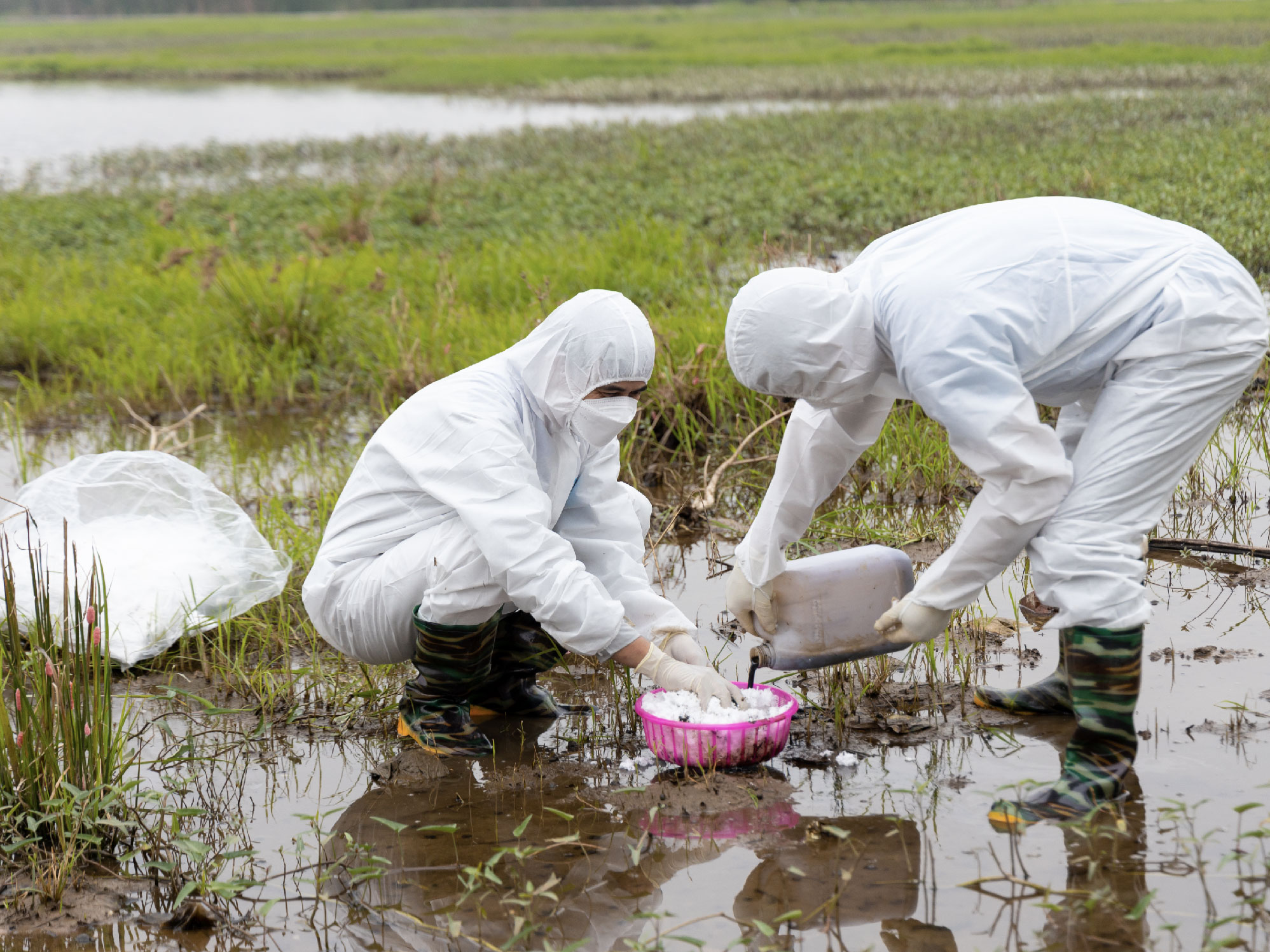
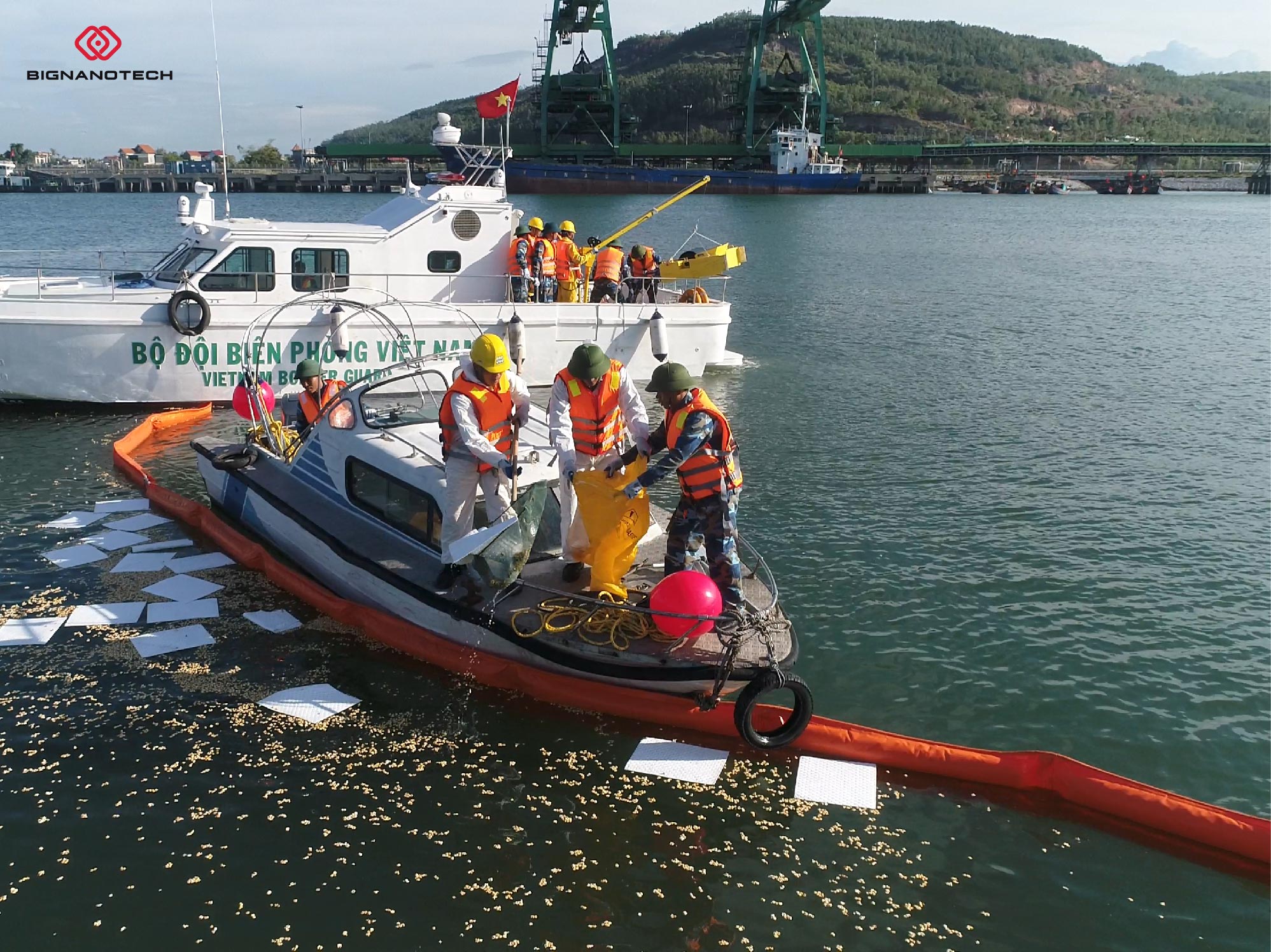
Currently, oil spills and oil leaks are potential dangers for coastal countries. In coastal countries, the phenomenon of "black tide" is common in sea areas. There are many causes of this situation such as collisions, accidents of water transport vehicles (especially oil tankers), drilling rig incidents, oil injection incidents due to geological fluctuations, and illegal dumping of waste oil. at sea or due to improper discharge processes of factories and manufacturing enterprises related to buckets and oil-based products...
Effects of oil spills on the environment

Oil spills often leave serious consequences, polluting the environment, affecting the ecological environment, aquatic resources, water, and land over a wide area, causing damage to economic activities. , especially the exploitation and use of aquatic resources.
For birds, oil spills make their feathers "wet", making them vulnerable, reducing their ability to fly. When birds preen their feathers and eat oily food, it irritates their digestive system, reduces lung function, causes metabolic imbalance, etc. If not rescued and treated promptly, they will die. . For mammals, when skin and fur are covered in oil, their ability to retain heat is reduced. Oil that penetrates into the body as well as into the stomach will cause hair loss, reduce digestive function, and cause dehydration.
Crude oil's main components are hydrocarbons with many unremoved components such as sulfur, nitrogen and many heavy metals. When oil spills, it reduces the light penetrating into the water, limiting the photosynthesis ability of marine plants, affecting the food chain in the ecosystem.
Oil spill in Vietnam
Each year, about 200 million tons of oil are transported through the waters off the coast of Vietnam, along the maritime route from the Middle East to Japan, North Korea... During the process of transportation and offshore exploitation, accidents may occur. Incidents (man-made, natural disasters...) lead to oil spilling into the sea, polluting the marine environment. According to statistics from the Ministry of Natural Resources and Environment and the National Committee for Search and Rescue, in the last 20 years, there have been about 10 major oil spills recorded every year, especially in 2012 there were up to 12 cases, affecting the environment. estuaries and coastal areas of our country. In particular, in January 2005, the oil tanker KASCO Monrovia collided with Cat Lai Jetty on the Saigon River, spilling 518 tons of DO oil. From the end of 2006 - 2007, a series of localities along the coast of Vietnam had oil clumping phenomena such as Quang Nam, Vung Tau, Thua Thien - Hue, affecting coastal ecosystems as well as other areas. coastal resort.
At the end of October 2007, the shipping ship New Oriental was in distress and sank in the waters of An Ninh Dong commune, Tuy An district, Phu Yen province. The oil spill spread about 500 meters southwest of the ship's sinking position with an area estimated to be about 25 hectares.
Ability to monitor oil spills using remote sensing images and GIS
Under current conditions in Vietnam, the application of remote sensing technology combined with GIS to monitor oil pollution incidents is an effective and feasible solution. Oil spills change the roughness of sea and river surfaces, so using radar images you can see the difference and identify oil streaks. Depending on the different causes, the morphology of oil streaks is also different. Based on the analysis of the time and location of the recorded morphology of oil streaks, it is possible to determine their origin.
Oil spill monitoring can take place continuously or when information about an oil spill becomes available. For continuous monitoring activities, the monitoring area will be imaged when a satellite passes through. Collected images will be processed and analyzed, looking for oil slicks at sea. When oil spill areas are identified, data related to oil slicks, currents, ocean waves, and sea surface temperature will be used integrated in a GIS environment to serve analysis and determination of the cause. oil spill. Image analysis can determine the size of the oil stain, the type of oil (crude oil or refined oil), whether the oil spill appears around the detected area on the image or is carried to another place by the flow. From there, you can find a quick and effective solution.

Currently, remote sensing data is diverse and collected with continuous repetition, capable of providing effective oil spill monitoring information. However, continuously captured remote sensing data serving oil spill monitoring in Vietnam's waters requires regular and large funding sources, so it is difficult to meet regular monitoring requirements.
Thus, in addition to using GIS remote sensing tools to monitor the appearance of oil slicks, it is also necessary to raise awareness of businesses and individuals when traveling at sea and during the production process. . Each unit needs to train staff to have skills to respond to incidents and at the same time provide equipment to help respond to incidents such as OIL-ABSORING FLOAT, OIL-ABSORING SHEET, OIL-ABSORING PILLOW, OIL-ABSORING ROLL, OIL-ABSORING COTTON FIBER. In order to bring advanced solutions to help thermal power companies and businesses... have optimal products to help overcome those problems, Bignanotech launches product lines that help overcome those problems, Bignanotech offers product lines to help deal with problems caused by oil such as OIL-ABSORING FLOAT, OIL-ABSORING SHEET, OIL-ABSORING PILLOW, OIL-ABSORING ROLL, OIL-ABSORING COTTON FIBER.

